Nicosia

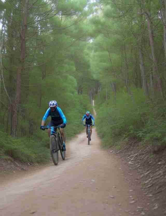
Nicosia MTB Route In The Forest

Nicosia

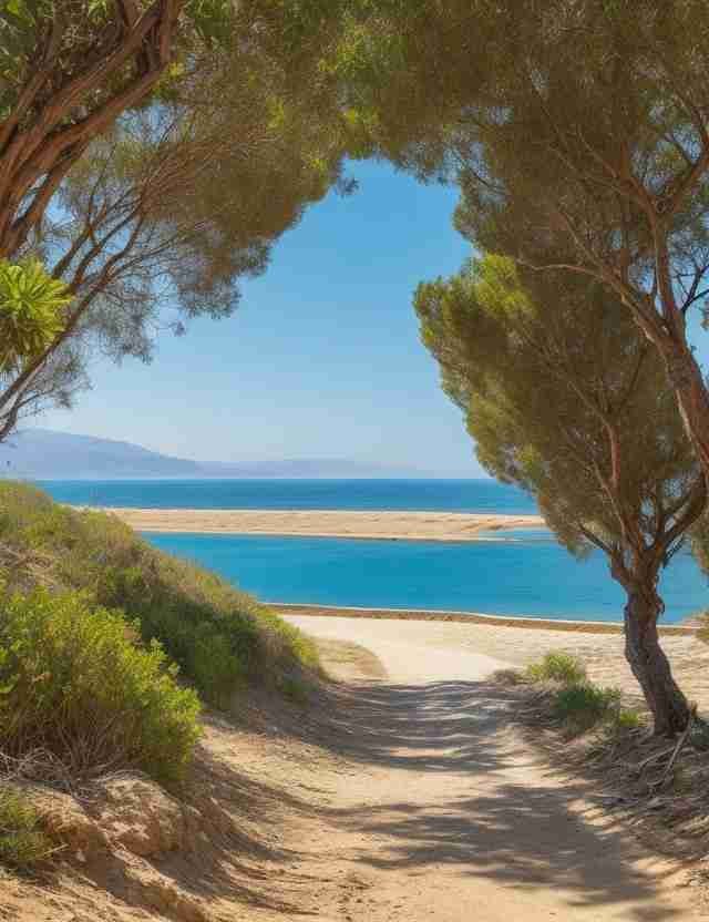
Embark on an exhilarating cycling adventure in Nicosia, conquering its varied terrain and dynamic bike trails, an ideal destination for cycling enthusiasts seeking novel outdoor challenges.

Athalassa Park Trail

Area:

Athalassa

Length:

5km

Duration:

Depends

Difficulty:

1-8/10

Type:

GPS:

Description

Experience this 5.0-km loop trail near Aglantzia, Nicosia. Generally considered a moderately challenging route, it takes an average of 1 h 7 min to complete. This is a popular trail for hiking, mountain biking, and running, but you can still enjoy some solitude during quieter times of the day.

Circular route in the Athalassa National Park, in the southeast of Nicosia. This is a green area, which offers outdoor recreation, trails, and mountain bike routes. The course starts south of the lake and heads northeast from where it returns southwest to the starting point. It is the largest free green area around Nicosia. The nature in the park gives the impression to the visitor that it is in a forest. It is also a popular mountain biking area, with more trails if you wish to extend your ride.

Machairas – Kionia

Area:

Machairas

Length:

9km

Duration:

3.5hours

Difficulty:

7/10

Type:

GPS:

Description

Explore this 8.9-kilometer loop trail in the vicinity of Lazanias, Nicosia. Generally regarded as a moderately challenging path, it typically takes an average of 3 hours and 28 minutes to complete. This trail is a popular choice for hikers and mountain biking enthusiasts, but you can still savor some tranquility during quieter times of the day. The best times to venture onto this trail range from March to December.

Machairas - Kionia (a segment of the E4 European Trail)

The circular course commences very close to Machairas Monastery, then proceeds south, ascending the ridge of Mount Machairas. The path continues along the mountain's ridge, forming a horseshoe shape around the Pedieos River valley, essentially tracing the river basin's watershed. It approaches near the Machairas or Kionia peak, offering splendid panoramic views of the surrounding landscape, before reaching the Kakokefalos col. From there, it descends towards the starting point.

Maglee Lake

Area:

Archangelos

Length:

7.2km

Duration:

1.5 hours

Difficulty:

5/10

Type:

GPS:

Description

Take pleasure in this 7.2-kilometer there-and-back trail close to Strovolos, Nicosia. Typically perceived as a moderately challenging course, it requires an average of 1 hour and 32 minutes to complete. This trail is well-frequented by hikers and mountain biking enthusiasts, yet it offers moments of serenity during off-peak times. It remains accessible throughout the year and is captivating to explore at any time.

Mandra Tou Kampiou – Kakokefalos

Area:

Machairas

Length:

5.5km

Duration:

2hours

Difficulty:

6/10

Type:

GPS:

Description

Discover this 5.5-kilometer point-to-point trail near Lazanias, Nicosia. It's generally acknowledged as a challenging path, typically requiring around 2 hours and 1 minute to complete. This trail is perfect for both hiking and mountain biking, and you're unlikely to come across many other adventurers during your journey. It's accessible year-round and offers its natural beauty at any time.

'Mandra tou Kampiou - Kakokefalos' Nature Trail

The journey commences from the 'Mandra tou Kampiou' picnic site and ascends to the southwest through lush greenery, passing by the remains of an ancient shrine. The path carries on until it intersects with the Machera-Konia dirt road, not far from the 'Kakokefalos' peak. The panoramic view of the surrounding landscape and the Mesaoria plain is simply stunning.

Larnaca

Larnaca MTB Route By The Sea

Larnaca

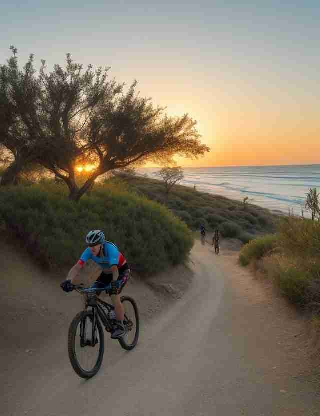
Kickstart an adrenaline-fueled cycling adventure in Larnaca, conquering its diverse landscape and thrilling bike trails, a top destination for cycling enthusiasts in search of new outdoor thrills.

Aradippou – Tersefanou – Dromolaxia

Area:

Kalo Chorio

Length:

30.4km

Duration:

6hours

Difficulty:

6/10

Type:

GPS:

Description

Embark on this 30.4km loop trail near Kalo Chorio, Larnaca. It's typically classified as a moderately challenging route, popular for mountain biking and bike touring, yet offers moments of solitude during quieter times of the day. This trail remains open year-round, showcasing its beauty for you to appreciate at any time.

This pleasant circular course commences in the suburb of Aradippou to the east of Larnaca and progresses southwestward, ascending towards the Rizoelia hills. It then descends southeastward, leading to the settlement of Tersefanou, and proceeds to the settlement of Kiti before turning northwestward towards Dromolaxia. Continuing in a northwesterly direction, the route ultimately returns to the starting point.

Alaminos To Troodos

Area:

Alaminos

Length:

135km

Duration:

10hours

Difficulty:

9/10

Type:

GPS:

Description

Explore this 135km point-to-point trail near Alaminos, Larnaca, which is generally acknowledged as a challenging route. It's an ideal choice for mountain biking and running, providing a serene and less crowded experience. The trail is accessible year-round and boasts its natural beauty, available for your enjoyment at any time.

Embark on a picturesque yet demanding 135km journey, commencing at Alaminos Beach on the Mediterranean shores of southern Cyprus and culminating in the Troodos Mountains. The trail initiates at the beach, heading northwest as it ascends into the mountainous interior of Cyprus, taking you through forests, orchards, mountain villages, farmlands, and several peaks, including the towering Chionistra at 1952 meters. The trail concludes in proximity to Troodos Square. In addition to this lengthy adventure, there are two shorter challenges available, spanning 54km and 25km.

Lythrodontas – Lefkara – Vavatsinia

Area:

Lythrodontas

Length:

44.6km

Duration:

7hours

Difficulty:

8/10

Type:

GPS:

Description

Indulge in this 44.6 kilometer circular trail in the vicinity of Lythrodontas, Nicosia. It's typically regarded as a moderately challenging path and is particularly well-suited for mountain biking. You're not likely to cross paths with many other individuals while exploring this trail. It remains accessible throughout the year, and its natural beauty is there to be enjoyed at any time.

Alaminos Circuit

Area:

Alaminos

Length:

10.5 km

Duration:

2 hours

Difficulty:

6/10

Type:

GPS:

Description

Embark on an adventure along this 10.5-kilometer circular trail near Alaminos, in the Larnaca District. Typically classified as an uncomplicated route, it usually takes about 2 hours and 5 minutes to complete. This trail is well-suited for hiking, mountain biking, and running, and you're not likely to encounter a lot of fellow travelers during your exploration. It remains accessible throughout the year and offers its scenic allure at any time.

The path initially guides you along a paved route and stairs, transitioning to gravel and sand along the seaside. It then veers slightly inland, where changes to the paths may occur, often due to ongoing construction projects. The return journey primarily follows gravel paths, occasionally leading onto a rural road. The sea remains visible from many vantage points along the way, making it relatively easy to maintain your bearings.

Oroklini Park And View Point

Area:

Oroklini

Length:

6.6km

Duration:

2 hours

Difficulty:

5/10

Type:

GPS:

Description

Discover this 6.6-kilometer circular trail in the vicinity of Oroklini, Larnaca. Generally considered to be of moderate difficulty, it typically takes around 1 hour and 57 minutes to complete. This trail is a favored destination for birdwatching, hiking, and mountain biking enthusiasts, yet you can still relish some peaceful moments during the quieter periods of the day.

Oroklini Park boasts an abundance of wildflowers, providing picturesque vistas of both the sea and mountains. It's an ideal pathway for runners and mountain bikers alike. Given its exposure to the sun, it's advisable to arrive early to avoid the midday heat. Donning a hat, layered clothing, and sunglasses is recommended. The starting point is flexible; commencing from the town is a wise choice, followed by a refreshing cold beer and a meal at one of the charming tavernas. You have the option to extend your walk to your heart's content, as this area is replete with numerous additional trails.

Limassol

Limassol MTB Route By The Sea

Limassol

Embark on an exhilarating cycling escapade in Limassol, navigating its varied terrain and dynamic bike trails, an ideal destination for cycling enthusiasts seeking exciting outdoor experiences.

Kalavasos – Kellaki – Akapnou

Area:

Asgata

Length:

33.6km

Duration:

7hours

Difficulty:

7/10

Type:

GPS:

Description

Explore this 33.6-kilometer circular trail in the vicinity of Asgata, Limassol. It's typically recognized as a moderately challenging path and is particularly well-suited for mountain biking. Meeting other individuals while exploring this trail is a rare occurrence. You can immerse yourself in its beauty throughout the year, making it a delightful place to visit at any time.

Tour Of The Waterfalls

Area:

Lemithou

Length:

42.5km

Duration:

8hours

Difficulty:

8/10

Type:

GPS:

Description

Embark on this 42.5km circular trail near Lemithou, Limassol. It's typically regarded as a demanding route and is particularly well-suited for mountain biking. It's uncommon to come across many other individuals while you're exploring this trail. You can immerse yourself in its beauty year-round, and it's a delightful place to visit at any time.

Sanida – Akapnou

Area:

Sanida

Length:

5.6km

Duration:

1.4hours

Difficulty:

6/10

Type:

GPS:

Description

Explore this 5.6km point-to-point trail in the vicinity of Sanida, Limassol. It's typically recognized as a moderately challenging path, typically taking an average of 1 hour and 46 minutes to complete. This trail is ideal for both hiking and mountain biking, and it's unusual to come across many other individuals while you're out exploring. You can enjoy this trail throughout the year, and its natural beauty is ready to be appreciated at any time.

Around Pissouri

Area:

Pissouri

Length:

7.4km

Duration:

2hours

Difficulty:

6/10

Type:

GPS:

Description

Uncover this 7.4-kilometer circular trail in the proximity of Pissouri, Limassol. It's typically perceived as a moderately challenging path, and the average completion time is approximately 2 hours and 7 minutes. This trail offers excellent opportunities for hiking, mountain biking, and running, and you're not likely to come across many other individuals during your exploration. It's accessible throughout the year, and its scenic allure is there to be enjoyed at any time.

Pachna – Tofoulia Hill

Area:

Pachna

Length:

6km

Duration:

1.4 hours

Difficulty:

6/10

Type:

GPS:

Description

Explore this 6.0-kilometer circular trail in the vicinity of Pachna, Limassol. It's typically seen as a moderately challenging path, and it typically takes about 1 hour and 41 minutes to complete. This trail offers excellent opportunities for both hiking and mountain biking, and it's not common to come across many other individuals during your journey. You can enjoy it year-round, and its natural beauty is there for you to appreciate at any time.

Machairas

Famagusta MTB Route By The Sea

Machairas

Begin an adrenaline-pumping cycling expedition in Machairas, mastering its diverse terrain and invigorating bike trails, a prime locale for cycling enthusiasts seeking fresh outdoor experiences.

Mandra Tou Kampiou – Kakokefalos

Area:

Machairas

Length:

5.5km

Duration:

2hours

Difficulty:

6/10

Type:

GPS:

Description

Discover this 5.5-kilometer point-to-point trail near Lazanias, Nicosia. It's generally acknowledged as a challenging path, typically requiring around 2 hours and 1 minute to complete. This trail is perfect for both hiking and mountain biking, and you're unlikely to come across many other adventurers during your journey. It's accessible year-round and offers its natural beauty at any time.

'Mandra tou Kampiou - Kakokefalos' Nature Trail

The journey commences from the 'Mandra tou Kampiou' picnic site and ascends to the southwest through lush greenery, passing by the remains of an ancient shrine. The path carries on until it intersects with the Machera-Konia dirt road, not far from the 'Kakokefalos' peak. The panoramic view of the surrounding landscape and the Mesaoria plain is simply stunning.
Machairas – Kionia

Area:

Machairas

Length:

9km

Duration:

3.5hours

Difficulty:

7/10

Type:

GPS:

Description

Explore this 8.9-kilometer loop trail in the vicinity of Lazanias, Nicosia. Generally regarded as a moderately challenging path, it typically takes an average of 3 hours and 28 minutes to complete. This trail is a popular choice for hikers and mountain biking enthusiasts, but you can still savor some tranquility during quieter times of the day. The best times to venture onto this trail range from March to December.

Machairas - Kionia (a segment of the E4 European Trail)

The circular course commences very close to Machairas Monastery, then proceeds south, ascending the ridge of Mount Machairas. The path continues along the mountain's ridge, forming a horseshoe shape around the Pedieos River valley, essentially tracing the river basin's watershed. It approaches near the Machairas or Kionia peak, offering splendid panoramic views of the surrounding landscape, before reaching the Kakokefalos col. From there, it descends towards the starting point.

Thanos

Area:

Machairas

Length:

7km

Duration:

10-20 minutes

Difficulty:

6/10

Type:

GPS:

Description

This classic trails located at the nearest mountains of nicosia starts near kionia peak and ends downt at mandra tou kampiou drops roughly 500m of elevation. The trails is mostly rocky with lond and fast straits, it also has some technical sections to be careful with. It is overall basic and somebody with a beginners skillset and a good working mountain bike will have a great time in.

Paphos

Paphos MTB Route In The Forest

Paphos

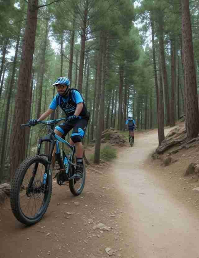
Embark on an adrenaline-fueled cycling odyssey in Paphos, conquering its diverse terrain and thrilling bike trails, a perfect destination for cycling enthusiasts seeking new outdoor adventures.

Diarizos – Arminou – Vretsia

Area:

Agios Nikolaos

Length:

36.4km

Duration:

8hours

Difficulty:

7/10

Type:

GPS:

Description

Experience this 36.4km circular trail in the vicinity of Agios Nikolaos, Paphos. It's typically regarded as a moderately challenging path and is ideal for mountain biking, offering a peaceful setting with limited encounters with other explorers. This trail welcomes visitors throughout the year, allowing you to revel in its natural beauty at your convenience.

Episkopi – Stavros Tis Minthis – Moro Nero

Area:

Episkopi

Length:

22km

Duration:

6.34hours

Difficulty:

7/10

Type:

GPS:

Description

Take pleasure in this 22km circular trail near Episkopi, Paphos. It's typically regarded as a challenging path, with an average completion time of approximately 6 hours and 34 minutes. This trail is perfectly suited for both hiking and mountain biking, and it's unlikely that you'll encounter many other people during your exploration. You can explore this trail year-round, and its beauty is there to be appreciated at any time.

Circumnavigate Episkopi and the charming Episkopi Traditional Resorts with this engaging tour. It's an excellent way to acquaint yourself with the region surrounding Episkopi. This mountain biking adventure is marked by demanding ascents and exhilarating descents. Some of the climbs are quite steep and strewn with rugged stones, which might present a challenge for beginners.

Yialia – Cape Akamas – Neo Chorio

Area:

Akamas

Length:

59.2km

Duration:

8hours

Difficulty:

8/10

Type:

GPS:

Description

Embark on an adventure along this 59.2km point-to-point trail near Γιαλιά, Paphos. It's typically recognized as a challenging path and is particularly well-suited for mountain biking. Meeting fellow travelers while exploring this trail is a rare occurrence. This scenic trail welcomes visitors throughout the year, offering its natural beauty for you to enjoy at any time.

Roudias Venetian Bridge – Vretsia

Area:

Vretsia

Length:

5.6km

Duration:

1.4hours

Difficulty:

5/10

Type:

GPS:

Description

Discover this 5.6km point-to-point trail in the vicinity of Mylikouri, Nicosia. It's typically perceived as a moderately challenging path, and it typically takes around 1 hour and 39 minutes to complete. This trail is well-suited for both hiking and mountain biking, and it's not common to come across many other individuals while exploring it. It's open throughout the year and offers its natural beauty for you to enjoy at any time.

Mandria – Asprokremmos Dam

Area:

Mandria

Length:

12.2km

Duration:

3hours

Difficulty:

7/10

Type:

GPS:

Description

Discover this 12.2-kilometer circular trail in the vicinity of Mandria, Paphos. It's typically seen as a moderately challenging path and is particularly well-suited for mountain biking. It's uncommon to come across many other individuals while exploring this trail. You can enjoy it throughout the year, and its natural beauty is there for you to appreciate at any time.

Inia – Akamas – Latsi

Area:

Akamas

Length:

35.4km

Duration:

9hours

Difficulty:

8/10

Type:

GPS:

Description

Savor this 35.4-kilometer point-to-point trail near Ineia, Paphos. It's generally acknowledged as a moderately challenging path, typically demanding about 8 hours and 46 minutes to complete. This trail is an ideal choice for both hiking and mountain biking, and you're unlikely to encounter many other adventurers during your expedition. It remains accessible year-round and is enchanting to explore at any time.

A lengthy course within the Akamas Forest, commencing from the Inia settlement and proceeding northwest into the protected area. The path meanders through the Akamas Forest before veering toward the coast, allowing you to explore Fontana Amorosa Beach and relish the breathtaking vistas from the Blue Lagoon scenic overlook. The trail continues along the southeastern coastline, passing by the Baths of Aphrodite and ultimately arriving at the coastal village of Latchi. This trail offers striking views that seamlessly blend the lush forest greens with the coastal beauty and the deep blue of the sea.

Minthis Hills

Area:

Tsada

Length:

11.17km

Duration:

3.36hours

Difficulty:

7/10

Type:

GPS:

Description

Familiarize yourself with this 11.7-kilometer loop trail in the vicinity of Tsada, Paphos. It's typically classified as a moderately challenging path, and it typically takes around 3 hours and 36 minutes to complete. This trail is a well-loved choice for hiking and mountain biking, yet you can still relish moments of tranquility during quieter times of the day. It's accessible throughout the year and is captivating to visit at any time.

This circular route is situated in western Cyprus, traversing the picturesque Minthis Hills. The path follows the road network and dirt roads, passing by the historical remains of the Agios Gennadios church in the deserted village of Moro Nero. It then leads south to the settlement of Episkopi, ascending from there to return to the starting point. Along the way, you'll be treated to splendid views of the Ezousas River valley to the east.

Lysos – Zacharia – Kios

Area:

Lysos

Length:

11.7km

Duration:

3.3 hours

Difficulty:

7/10

Type:

GPS:

Description

Explore this 11.7-kilometer loop trail near Lysos, Paphos, which is generally regarded as a moderately challenging route and typically takes around 3 hours and 26 minutes to complete. This trail is ideal for both hiking and mountain biking, and you're unlikely to encounter many other adventurers while exploring it. It's accessible year-round and offers its scenic charm at any time.

Embark on a circular journey through the hilly, rural landscapes of the Paphos district, commencing from Lysos village and venturing towards Zacharia and Kios. The path traces a dirt road that meanders through the entire agricultural region, ultimately circling back to the starting point. Revel in the breathtaking, panoramic vistas of the picturesque hills and valleys that surround you.

Around Kouklia

Area:

Kouklia

Length:

7.1 km

Duration:

1.45 hours

Difficulty:

6/10

Type:

GPS:

Description

Discover this 7.1-kilometer circular trail in the vicinity of Kouklia, Paphos. Typically categorized as a straightforward route, it typically takes an average of 1 hour and 44 minutes to complete. This trail offers excellent opportunities for hiking, mountain biking, and running, and you're unlikely to come across many other individuals during your adventure. The trail remains accessible year-round and offers its scenic charm at any time you choose to explore it.

Tala – Kili – Kamares

Area:

Tala

Length:

12.6km

Duration:

4 hours

Difficulty:

6/10

Type:

GPS:

Description

Familiarize yourself with this 12.6-kilometer circular trail in the vicinity of Tala, Paphos. It's typically regarded as a moderately challenging path, requiring an average of 3 hours and 57 minutes to traverse. This trail offers an excellent opportunity for both hiking and mountain biking, and you're unlikely to cross paths with many other visitors during your exploration. The trail remains accessible throughout the year and boasts its beauty at any time you choose to visit.

Paphos And Saranta Kolones Castle

Area:

Paphos

Length:

4km

Duration:

48min

Difficulty:

3/10

Type:

GPS:

Description

Enjoy this 4.0km loop trail near Paphos, Paphos. Generally considered an easy route, it takes an average of 48 min to complete. This is a popular trail for hiking, mountain biking, and running, but you can still enjoy some solitude during quieter times of the day. The trail is open year-round and is beautiful to visit anytime. Dogs are welcome but must be on a leash.

Troodos

Troodos MTB Route In The Forest

Troodos

Set off on an adrenaline-pumping cycling journey through Troodos mountain, conquering its rugged terrain and exhilarating bike trails, an idyllic destination for cycling enthusiasts seeking fresh outdoor challenges.

(1A) Psilo Dentro – Karvounas

Area:

Pano Platres

Length:

16.2km

Duration:

2hours

Difficulty:

4/10

Type:

GPS:

Description

The area of Karvounas serves as a central hub in the Troodos cycling network. It marks the administrative boundary between the Limassol District to the south and the Nicosia District to the north. Along the initial 9 kilometers of the route, you'll find a total of seven lookout points and rest stops. These spots offer picturesque views of the Platra Valley, which connects the route to the village of Moniatis. To the south, you'll see the island's southern shores and the city of Limassol, extending all the way to Cape Gata on the horizon.

The path crosses the Mesa Potamos River 6 kilometers from the starting point. The dense vegetation on the eastern slopes of the Troodos mountain range creates a refreshing, almost cool, environment, making it a welcomed rest area during the hotter summer months. Rest benches are available, along with fresh running water freely accessible to visitors for a quick refreshment break. The nearby village of Pano Platres, just 1 kilometer away, offers hotels and other tourist accommodations, restaurants, cafes, banks, and shops.

1(B) Karvounas – Prodromos

Area:

Karvounas

Length:

22.7km

Duration:

3.5hours

Difficulty:

6/10

Type:

GPS:

Description

The Karvounas – Prodromos route consists of two distinct segments: a 10km descent, covering 8km along a forest dirt track, followed by a gradual ascent spanning the remaining 12.7km. This route is classified as moderately challenging.

At the initially marked viewpoint, located 5km from the starting point, the village of Kakopetria extends down into the heart of the Solea Valley.

Approximately 15km into the route, cyclists reach the Stavroullia rest and viewing point. Here, and at the Marathos picnic site another 2.5km down the road, the Marathasa valley unveils its magnificence with the villages of Pedoulas, Moutoullas, and Kalopanagiotis to the west. Further to the north, the village of Gerakies nestles against the backdrop of the Kykkos mountain peak and its renowned monastery.

(1C) Prodromos – Psilo Dentro

Area:

Prodromos

Length:

18.2km

Duration:

3hours

Difficulty:

4/10

Type:

GPS:

Description

This 18.2km route commences from the village of Prodromos. To the north, you'll spot the abandoned Berengaria hotel complex, while further downhill, the village of Lemithou offers vistas of the shimmering Morfou Bay in the distance. Heading west, the Throni and Tripylos peaks provide commanding views of Kykkos and Stavros tis Psokas, respectively. Below, you'll find the villages of Palaiomylos and Agios Dimitrios, along with the expansive Diarizos Valley. Paphos forest stretches out towards the west. To the east, the Prodromos dam comes into view, along with a picnic site. To the south lies the Trikoukkiotissa Convent.

Around Troodos (1A+B+C)

Area:

Psilo Dentro

Length:

57km

Duration:

8hours

Difficulty:

7/10

Type:

GPS:

Description

Cycling Around Troodos, from Karvounas to Platres and Prodromos, you'll notice a distinctive blue marking running alongside the road. Many people are curious about its purpose, especially considering that it wasn't part of the island's Highway Code until recently. This blue line signifies the inception of Cyprus's first cycling network, spanning a total of 57km. The network combines both asphalt roads and dirt tracks to create a complete circular route within the Troodos National Forest.

In essence, this infrastructure is being established to cater to a different kind of tourism – sports tourism, primarily targeted at experienced cyclists, given the challenges presented by the dirt tracks.

The Troodos perimeter ring is divided into three distinct sections:

1(A) The initial cycling route, measuring 16.2km in length, starts at the Psilo Dendro restaurant in Platres and extends to Karvounas.

1(B)The second section, covering 22.7km, begins at Karvounas and leads all the way to Prodromos.

1(C)The third leg, spanning 18.2km, commences from Prodromos and concludes in Platres.

Kannoures – Agios Nikolaos

Area:

Kannoures

Length:

15.6km

Duration:

3hours

Difficulty:

6/10

Type:

GPS:

Description

An exceptionally scenic trail commences close to the Troodos camp area, tracing the course of the Karkotis River as it descends northward. Along the way, it passes by the disused chrome mine, leading toward the charming village of Kakopetria. The journey eventually nears the 12th-century UNESCO World Heritage-listed Church of Agios Nikolaos tis Stegis, known for its outstanding frescoes.


Mnimata Ton Piskopon

Area:

Troodos

Length:

6km

Duration:

35mins

Difficulty:

7/10

Type:

GPS:

Description

Starts with steep, winding, and highly rapid 4x4/Quad tracks, transitioning into a delightful singletrack trail. It's quite lengthy and can be quite exposed at times. Expect plenty of rugged terrain—rocks galore—and loose surfaces throughout.

The journey concludes on a dirt road, a few kilometers beyond the Kakopetria village. Once you exit the trail, simply follow the downhill dirt roads, and you'll eventually arrive in Kakopetria. Unless you have extraordinary leg power, it's advisable to consider shuttle options. Be sure to consult the bus schedule as they can accommodate 1-2 bikes for the return trip to the top.

Troodos Square – Paphos

Area:

Troodos Square

Length:

65km

Duration:

7hours

Difficulty:

8/10

Type:

GPS:

Description

Covering a distance of 65 kilometers, this route connects the Troodos region with Pafos (Paphos), leading you through the charming villages of the Diarizos River Valley. Beginning at Troodos Square, the journey heads south along the primary Lemesos (Limassol) - Troodos road. At Psilo Dendro, it takes a right turn, leading to Pano Platres and then onward to Kato Platres. Just beyond Kato Platres, it veers right towards Mandria and Pafos. Continuing southwest, the route passes through Mandria and enters the Diarizos Valley, taking you through the villages of Agios Nikolaos, Praitori, Kedares, Kidasi, Agios Georgios, Mamonia, Fasoula, and Nikokleia, ultimately rejoining the old Lemesos - Pafos road. From there, it heads west, guiding you to Pafos through the villages of Mandria, Timi, Acheleia, and Geroskipou.

Troodos Square – Stavros Tis Psokas

Area:

Troodos Square

Length:

55km

Duration:

6hours

Difficulty:

7/10

Type:

GPS:

Description

The route starts from Troodos Square, heading west for approximately 2.5km, at which point it veers left towards Mount Olympos. From here, it descends towards the village of Prodromos. The path then turns right into the Pinewood area, traveling above Pedoulas village until it reaches Kykkos Monastery. At this juncture, there's an opportunity to pause at the Kykkos restaurant before proceeding to Kampos.

Before reaching Kampos, a left turn opens the path to Stavros tis Psokas to the west, and after another 3.5km, another left turn guides you to the Cedar Valley. The route continues straight for another 16km until you encounter a left turn leading to the Stavros tis Psokas forestry station, situated 3km along the route. Here, you'll find a restaurant, hostel, picnic area, camping site, and a designated enclosure for indigenous moufflon (mountain goats).