Troodos

Troodos MTB Route In The Forest

Troodos

Set off on an adrenaline-pumping cycling journey through Troodos mountain, conquering its rugged terrain and exhilarating bike trails, an idyllic destination for cycling enthusiasts seeking fresh outdoor challenges.

(1A) Psilo Dentro – Karvounas

Area:

Pano Platres

Length:

16.2km

Duration:

2hours

Difficulty:

4/10

Type:

GPS:

Description

The area of Karvounas serves as a central hub in the Troodos cycling network. It marks the administrative boundary between the Limassol District to the south and the Nicosia District to the north. Along the initial 9 kilometers of the route, you'll find a total of seven lookout points and rest stops. These spots offer picturesque views of the Platra Valley, which connects the route to the village of Moniatis. To the south, you'll see the island's southern shores and the city of Limassol, extending all the way to Cape Gata on the horizon.

The path crosses the Mesa Potamos River 6 kilometers from the starting point. The dense vegetation on the eastern slopes of the Troodos mountain range creates a refreshing, almost cool, environment, making it a welcomed rest area during the hotter summer months. Rest benches are available, along with fresh running water freely accessible to visitors for a quick refreshment break. The nearby village of Pano Platres, just 1 kilometer away, offers hotels and other tourist accommodations, restaurants, cafes, banks, and shops.

1(B) Karvounas – Prodromos

Area:

Karvounas

Length:

22.7km

Duration:

3.5hours

Difficulty:

6/10

Type:

GPS:

Description

The Karvounas – Prodromos route consists of two distinct segments: a 10km descent, covering 8km along a forest dirt track, followed by a gradual ascent spanning the remaining 12.7km. This route is classified as moderately challenging.

At the initially marked viewpoint, located 5km from the starting point, the village of Kakopetria extends down into the heart of the Solea Valley.

Approximately 15km into the route, cyclists reach the Stavroullia rest and viewing point. Here, and at the Marathos picnic site another 2.5km down the road, the Marathasa valley unveils its magnificence with the villages of Pedoulas, Moutoullas, and Kalopanagiotis to the west. Further to the north, the village of Gerakies nestles against the backdrop of the Kykkos mountain peak and its renowned monastery.

(1C) Prodromos – Psilo Dentro

Area:

Prodromos

Length:

18.2km

Duration:

3hours

Difficulty:

4/10

Type:

GPS:

Description

This 18.2km route commences from the village of Prodromos. To the north, you'll spot the abandoned Berengaria hotel complex, while further downhill, the village of Lemithou offers vistas of the shimmering Morfou Bay in the distance. Heading west, the Throni and Tripylos peaks provide commanding views of Kykkos and Stavros tis Psokas, respectively. Below, you'll find the villages of Palaiomylos and Agios Dimitrios, along with the expansive Diarizos Valley. Paphos forest stretches out towards the west. To the east, the Prodromos dam comes into view, along with a picnic site. To the south lies the Trikoukkiotissa Convent.

Around Troodos (1A+B+C)

Area:

Psilo Dentro

Length:

57km

Duration:

8hours

Difficulty:

7/10

Type:

GPS:

Description

Cycling Around Troodos, from Karvounas to Platres and Prodromos, you'll notice a distinctive blue marking running alongside the road. Many people are curious about its purpose, especially considering that it wasn't part of the island's Highway Code until recently. This blue line signifies the inception of Cyprus's first cycling network, spanning a total of 57km. The network combines both asphalt roads and dirt tracks to create a complete circular route within the Troodos National Forest.

In essence, this infrastructure is being established to cater to a different kind of tourism – sports tourism, primarily targeted at experienced cyclists, given the challenges presented by the dirt tracks.

The Troodos perimeter ring is divided into three distinct sections:

1(A) The initial cycling route, measuring 16.2km in length, starts at the Psilo Dendro restaurant in Platres and extends to Karvounas.

1(B)The second section, covering 22.7km, begins at Karvounas and leads all the way to Prodromos.

1(C)The third leg, spanning 18.2km, commences from Prodromos and concludes in Platres.

Kannoures – Agios Nikolaos

Area:

Kannoures

Length:

15.6km

Duration:

3hours

Difficulty:

6/10

Type:

GPS:

Description

An exceptionally scenic trail commences close to the Troodos camp area, tracing the course of the Karkotis River as it descends northward. Along the way, it passes by the disused chrome mine, leading toward the charming village of Kakopetria. The journey eventually nears the 12th-century UNESCO World Heritage-listed Church of Agios Nikolaos tis Stegis, known for its outstanding frescoes.


Mnimata Ton Piskopon

Area:

Troodos

Length:

6km

Duration:

35mins

Difficulty:

7/10

Type:

GPS:

Description

Starts with steep, winding, and highly rapid 4x4/Quad tracks, transitioning into a delightful singletrack trail. It's quite lengthy and can be quite exposed at times. Expect plenty of rugged terrain—rocks galore—and loose surfaces throughout.

The journey concludes on a dirt road, a few kilometers beyond the Kakopetria village. Once you exit the trail, simply follow the downhill dirt roads, and you'll eventually arrive in Kakopetria. Unless you have extraordinary leg power, it's advisable to consider shuttle options. Be sure to consult the bus schedule as they can accommodate 1-2 bikes for the return trip to the top.

Troodos Square – Paphos

Area:

Troodos Square

Length:

65km

Duration:

7hours

Difficulty:

8/10

Type:

GPS:

Description

Covering a distance of 65 kilometers, this route connects the Troodos region with Pafos (Paphos), leading you through the charming villages of the Diarizos River Valley. Beginning at Troodos Square, the journey heads south along the primary Lemesos (Limassol) - Troodos road. At Psilo Dendro, it takes a right turn, leading to Pano Platres and then onward to Kato Platres. Just beyond Kato Platres, it veers right towards Mandria and Pafos. Continuing southwest, the route passes through Mandria and enters the Diarizos Valley, taking you through the villages of Agios Nikolaos, Praitori, Kedares, Kidasi, Agios Georgios, Mamonia, Fasoula, and Nikokleia, ultimately rejoining the old Lemesos - Pafos road. From there, it heads west, guiding you to Pafos through the villages of Mandria, Timi, Acheleia, and Geroskipou.

Troodos Square – Stavros Tis Psokas

Area:

Troodos Square

Length:

55km

Duration:

6hours

Difficulty:

7/10

Type:

GPS:

Description

The route starts from Troodos Square, heading west for approximately 2.5km, at which point it veers left towards Mount Olympos. From here, it descends towards the village of Prodromos. The path then turns right into the Pinewood area, traveling above Pedoulas village until it reaches Kykkos Monastery. At this juncture, there's an opportunity to pause at the Kykkos restaurant before proceeding to Kampos.

Before reaching Kampos, a left turn opens the path to Stavros tis Psokas to the west, and after another 3.5km, another left turn guides you to the Cedar Valley. The route continues straight for another 16km until you encounter a left turn leading to the Stavros tis Psokas forestry station, situated 3km along the route. Here, you'll find a restaurant, hostel, picnic area, camping site, and a designated enclosure for indigenous moufflon (mountain goats).


Limassol

Millomeri Waterafall Limassol

Limassol

Embark on a thrilling hiking adventure in Limassol, revealing its natural wonders and concealed trails. This area is ideal for outdoor enthusiasts in search of new experiences.

Diosmides – Geratzia

Area:

Potamitissa

Length:

2km

Duration:

45mins

Type:

Linear

GPS:

Description

Diosmides – Geratzia is a recently established nature trail located in Potamitissa. This easy trail provides a delightful journey through diverse landscapes. Starting from the newly constructed water reservoir in Potamitissa village, it leads you through the Pazinos residential area, offers scenic views from the Skouri viewpoint, and concludes in the Geratzia region along the main road connecting Potamitissa and Agridia. The trail covers a distance of 1.5 kilometers and can be completed in about 50 minutes. Situated in an ideal setting, it allows hikers to explore Potamitissa while savoring the rich colors and fragrances of the local flora.

Agros – Kato Milos

Area:

Agros

Length:

6km

Duration:

2hours

Difficulty:

Type:

Circular

GPS:

Description

Along the trail, one encounters orchards with apple, cherry, and pear trees, as well as vineyards and rose gardens (Rosa damascena), which produce the renowned Agros rosewater. It also passes through a forested area and offers beautiful views of the surrounding area. The last part of the trail follows an asphalt road that leads to Agros

Germasogeia Dam – Korifi – Foinikaria

Area:

Germasogeia

Length:

7km

Duration:

2.5Hours

Difficulty:

Type:

Circular

GPS:

Description

Embark on this 7km loop trail in the vicinity of Yermasoyia, Limassol. Typically regarded as a moderately challenging path, it typically takes about 2.5hoursminutes to complete. Although this is a well-frequented hiking trail, there are opportunities to relish peaceful moments during quieter hours of the day. The trail remains accessible throughout the year, offering its beauty for exploration at any time.

Kalevounari

Area:

Polemidia

Length:

1km

Duration:

30mins

Type:

Circular

GPS:

Description

Along the trail, there are exceptional viewpoints overlooking the Akrotiri Peninsula, the communities west of Limassol City, and the Troodos mountain range.

Six Fountains (6 Vryses)

Area:

Arsos

Length:

2km

Duration:

45mins

Type:

Linear

GPS:

Description

The Six Springs (6 Vryses) in Arsos offers a delightful, uncomplicated path that links six ancient water fountains, making it accessible for all. These springs flow consistently throughout the year, nurturing the local flora and fauna. In medieval times, these fountains held great significance, as they provided the village's inhabitants with essential water for their homes and livestock, even during dry spells.

For many years, the six springs lay concealed beneath lush vegetation. However, with support from the Development Association, the Arsos Community Council, the Cyprus Tourism Organisation, and the Forest Department, the riverbed was cleared, and a pathway was constructed. This allows visitors to relish these historical water sources:

1. "Athkies," the initial fountain and starting point of the trail, is named after the surrounding willow trees.

2. The "Oss’ arkatzin" fountain was used to irrigate the nearby orchards, and near it stands the Byzantine monastery of Panagia Katholiki.

3. The Pano Vrysi fountain, the third in line, features a fascinating structure. A wooden staircase guides you to its location, where, until the early 1950s, village women used it for washing their clothes and linen.

4. The fourth fountain, Kostena, was transformed into a water tank during the early 1970s.

5. Koupas, the fifth fountain, primarily served as a water source for animals. It's a small faucet with basins and may be easily missed on your walk. Keep an eye out for signage on your left after passing the Kostena fountain.

6. The final fountain, Poulli, is a two-arch structure and marks the trail's conclusion.

Dymes – Pelendri

Area:

Dymes

Length:

4.5km

Duration:

1.5hours

Difficulty:

Type:

Linear

GPS:

Description

This is an old trail that used to connect the communities of Dymes and Pelendri. It passes through orchards of fruit trees, Trachia Pine forest, and the location known as "Deisi," also known as the throne of Panagia. There is a spring with drinking water along the trail. In August 2007, a fire in the area burned vegetation along a significant portion of the trail.

Kastrovounos

Area:

Kato Platres

Length:

2km

Duration:

45mins

Type:

Linear

GPS:

Description

The trail is located in the community forest of Kato Platres, to the west of the community. From various points along the trail, hikers can enjoy views of the surrounding communities in the Limassol district, Troodos National Forest Park, and Paphos Forest. The trail is illuminated throughout its length and is suitable for night hiking.


Millomeris Waterfall

Area:

Platres

Length:

1.2km

Duration:

40mins

Type:

Linear

GPS:

Description

At the end of the route, there is the possibility of accessing the waterfall by vehicle, via dirt roads starting from a point on the main Pera Pedi - Limassol road, about 1km after the Psilo Dendro. The path leads to the Myllomeri waterfall through rich vegetation. The first half of the route follows a course parallel to the Kryos River. The second half leads to an open mountain with phrygana and low shrub vegetation, as well as an excellent view of the south.

Prodromos – Lemithou

Area:

Prodromos

Length:

2km

Duration:

1hour

Type:

Linear

GPS:

Description

The Levendi family residence, the gorge in the Kremmos location, the Agros River, and the chapel of Agios Georgios.

The route towards the peak below “Verengaria” disused hotel. The trail ends past “Mitsis” school, at Lemithou village. Return via the same route, or alternatively via the Lemithou-Prodromos main road. A pleasant route through a thick black pine area. Scenic views all around.

Note: The path can also be made circular if the hiker returns from the main road Tris Elies - Lemythou.

Tris Elies

Area:

Kaminaria

Length:

2km

Duration:

35mins

Type:

Linear

GPS:

Description

You can find the Medieval Bridge of Mylos and the Bridge of Tris Elies. It follows the course along the river of Tris Elies, through rich riparian vegetation and through orchards with cherry, apple, and walnut trees. The path also passes through the ruins of the Church of Agios Andronikos.

Kyparissia – Germasogeia Dam

Area:

Germasogeia

Length:

11km / 3.7km

Duration:

3.5hours / 1.5hours

Difficulty:

Type:

Liner

GPS:

Description

Initially, it is a partially forested path, a short distance along the Kyparissia River, and then offers a panoramic view of Germasogeia Dam and Limassol. The trail passes through a forest with rare natural clusters of cypress trees (Cupressus sempervirens var. horizontalis).

Two routes.

- The first route ends at Germasogeia Dam with a total length of 11km. (3-3.5 hours, mostly downhill at the beginning).

- The second route is circular with a length of 3.7km. (1.5 hours, mostly downhill at the beginning).

Apollon Hylatis

Area:

Curium

Length:

2km

Duration:

1hour

Type:

Linear

GPS:

Description

The visitor passes through shrubbery with junipers, Juniperus, and sparse pines. The path passes by the ancient stadium of Kourion and ends on a hill next to the Basilica outside the walls of Kourion, offering a panoramic view of the ancient settlement located on the opposite slope and the Episkopi beach.

Moni – Fylagra

Area:

Trimiklini

Length:

3km

Duration:

1hour

Type:

Linear

GPS:

Description

It is a linear trail 3 km long and it can be walked in one (1) hour (2 hours to return). One point of the trail runs along the main Trimiklini-Pelendri road, just before the bakery. If one selects this as a starting point, there is a short section at the beginning that runs uphill, while the rest is downhill. The opposite is true if one selects the other end as a starting point, the one situated near the main road of Kato Amiantos- Fylagra, in the Fylagra built-up area. There are information signs regarding the two starting points on the main Kato Amiantos-Saitas road and Trimiklini-Pelendri road.

You can enjoy views of Limassol Bay, Kouris Dam, villages of the Limassol province, the eastern part of Troodos Forest, and the Kouris River. The vegetation of the area was completely destroyed by the major fire in June 2007 and is in the process of recovery.


Kato Amiantos – Loumata ton Aeton

Area:

Kato Amiantos

Length:

2.5 km

Duration:

1hour

Type:

Circular

GPS:

Description

Discover this 2.5km loop trail in the vicinity of Amiantos, Limassol. It's typically rated as a moderately challenging route, with an average completion time of around 53 minutes. Although a well-frequented trail for hikers, you can still find moments of serenity during off-peak hours. This trail welcomes visitors year-round and offers its beauty at any time of the year.

It crosses a beautiful slope and follows along the river through lush vegetation, ending at Amiantos Park. It passes by the old restored refuge of EOKA fighters and the Loumata ton Aeton River. It can be made circular by following roads within the community towards the SEK Camp.

Mnimata Ton Piskopon

Area:

Troodos

Length:

8km

Duration:

3hours

Difficulty:

Type:

Out & Back

GPS:

Description

The starting point is located approximately 300m up on the narrow paved road. After a 1km journey on a widened path for easy wheelchair access, the hiker reaches a crossroad with a wooden sign indicating "Mnimata Piskopon" (northwest), while the first kilometer is part of the "Kampos tou Livadiou" trail. It ends at the dirt road that connects Platanias with the church of Agios Nikolaos Stegis (12th century), which features exceptional frescoes and is included in the UNESCO World Heritage List https://whc.unesco.org/

The trail passes through clusters of black pine and follows a route near the cliffs, offering views of the Chromio River, the Solea Valley, and Morphou Bay. The trail ends at the dirt road connecting Platanias, Apotheeri, and Agios Nikolaos with three different routes leading to Agios Nikolaos  Stegis in the village of Kakopetria, Platanias, and vice versa. It connects with the Kampos tou Livadiou Path and the Livadi Path.

Kampos Tou Livadiou

Area:

Pano Platres

Length:

3.2km

Duration:

1hour

Type:

Circular

GPS:

Description

You can find a significant number of centuries-old black pine trees. It passes close to the recreational area "Kampos tou Livadiou." It connects with the Mnimata Piskopon Trail and the Livadi Trail.

Discover this 3.2-kilometer loop trail in the vicinity of Pano Platres, Limassol. Typically categorized as an uncomplicated path, it typically requires about 51 minutes to finish. This trail is well-liked among hikers, and you can savor moments of tranquility, especially during less busy periods. For the finest experience, plan your visit between March and November.

Psilo Dentro – Pouziaris

Area:

Pano Platres

Length:

9km

Duration:

4hours

Difficulty:

Type:

Circular

GPS:

Description

It follows a route through dense clusters of rough pine trees (Pinus brutia) for the first kilometer, while at the third kilometer, at the highest points, it crosses through a dense and impressive forest of black pine (Pinus nigra subsp. pallasiana). At its highest points, it offers panoramic views.

Commencing at Psilo Dentro in Pano Platres, this circular route climbs the southern slopes of Mount Troodos, proceeding eastward. It offers a magnificent, expansive view of the surrounding area and the southern landscape. This trail can easily be linked with other paths within the Nature Hiking Trails network on Mount Troodos. It then loops back to the south, ultimately concluding at its starting point.

Kaledonia Waterfall

Area:

Troodos

Length:

4km

Duration:

1.5hours

Type:

Linear

GPS:

Description

Starting from the side of Troodos Square, the trail passes through dense forests and follows along the course of Kryos Potamos, which has a permanent flow of water. It passes by the Kaledonia waterfalls and ends at Psilo Dentro in Upper Platres. From starting point (a) to the Kalidonia waterfalls, it is part of the European Path E4.

Persephone

Area:

Troodos

Length:

4km

Duration:

1hour

Type:

Linear

GPS:

Description

Rich vegetation, where the hiker passes through a dense forest of black pine for the first 2km, and excellent views from the endpoint at the location Makria Kontarka. The trail can be combined with the Pouziaris and Kaledonia trails. Approximately 500 meters before the endpoint, the trail intersects with the forest road that leads from Troodos Square to Kryo Potami. It is part of the European Path E4.

Atalante

Area:

Troodos

Length:

14km

Duration:

4hours

Difficulty:

Type:

Circular

GPS:

Description

The trail follows a path around Chionistra at an altitude of 1700-1750m, passing through dense clusters of black pine and Troodos juniper. There is one of the largest juniper trees, approximately 800 years old. It offers excellent views in general of the island's regions. Of particular interest is the entrance to a gallery for chromium mining that has been out of operation since 1982.

The trail ends on the Troodos - Prodromos road after 9km. To continue, one must cross the main road and walk approximately 200m on the Chromio Houses forest road towards Agios Nikolaos Stegis. There is a wooden signpost indicating the direction of the trail. From there, the trail continues with a route roughly parallel to the main road and ends at Troodos Square. There is a drinking water fountain 3km from the starting point. Its course is parallel to the Artemis Trail, and at points where the routes approach each other, they can be combined with hiking on the Artemis Trail.

Artemis

Area:

Pano Platres

Length:

8km

Duration:

3hours

Difficulty:

Type:

Circular

GPS:

Description

The black pine forest, rare flora species, and rocks of the area. There is access to two centuries-old black pine trees (Pinus nigra subsp. pallasiana) approximately 500 years old. Of historical interest is the "Teisia of the old town," which are ruins of makeshift fortifications built during the last years of Venetian rule in Cyprus (1571 AD) by a group of Venetian strategists who decided to defend against the Turks. The route is circular around the peak of Olympus (Chionistra) at an altitude of 1850m and offers excellent views in all directions. Its course is parallel to the Atalante Trail, and at points where the routes approach each other, they can be combined with hiking on the Atalante Trail.

Prodromos Dam – Stavroulia

Area:

Prodromos

Length:

4.5-5.5km

Duration:

1.5-2hours

Difficulty:

Type:

Linear

GPS:

Description

Enjoy a stunning view of Morphou Bay and the Troodos Mountain Range as you traverse this trail. The path guides you through the dense black pine forests of Troodos National Forest Park, offering panoramic vistas to the east, including the abandoned galleries of the chrome mines.

Trail Length: The first route covers 4.5km, while the second route spans 5.5km.

Experience the beauty of this breathtaking landscape while wandering through the lush pine forest in Troodos National Forest Park, and take in the panoramic views to the east, which reveal the remnants of the abandoned chrome mines.

Prodromos – Zoumi

Area:

Prodromos

Length:

3km

Duration:

1.5hours

Difficulty:

Type:

Linear

GPS:

Description

The trail passes through natural clusters of black pine and offers panoramic views of Marathasa Valley, Morphou Bay, Kykkos Monastery, Tripouli, and Mount Panagia. At the location of Zoumi, the trail connects with Prodromos Dam - Stavroulia trail.

Note: The trail can be made circular if the hiker uses the Prodromou - Troodos road, with an additional distance of 2.7km.

Trooditissa Monastery – Phoini

Area:

Foini

Length:

4.5km

Duration:

1.5hours

Type:

Circular

GPS:

Description

The notable features encountered by the hiker include the "Chantara" waterfall, located approximately 3km from Trooditissa Monastery, the rich vegetation of the area, and the panoramic view of the Phoini community.

Typically viewed as a moderately challenging trail, it typically takes around 1 hour and 21 minutes to complete. This path is perfect for hiking, and you're unlikely to come across many fellow hikers while you explore. You can enjoy this trail all year long, and it's stunning to visit at any time.

Prodromos – Lemithou

Area:

Prodromos

Length:

2km

Duration:

1Hour

Difficulty:

Type:

Linear

GPS:

Description

You can see the abandoned Veregaria Hotel. Natural clusters of black pine and a view towards western Marathasa and Paphos Forest. The trail ends slightly above Mitsis School in the village of Lemithou. The hiker can return back on the same path or via the Lemithou - Prodromos asphalt road.

Xylofagou

Cave Dive Xylofagou

Xylofagou

Delve into a thrilling scuba diving adventure in Xylophagou, uncovering its underwater marvels and uncharted dive locations, a paradise for scuba enthusiasts seeking aquatic exploration.

Nail

Dive Spot:

Pyla Pirate Caves

Min. Qualification:

Open Water

Site Type:

Rocky and small canyons

Max Depth:

17m

Dive Type:

Recreational Diving

Visibility:

20m plus in good conditions

Access:

Shore Access

GPS:

Characteristics

  • Very similar and very close to the Bullet Point dive site.
  • Almost always there are good conditions.
  • Very nice marine life with sea slugs, starfish, and moray eels.

Bullet Point

Dive Spot:

Pyla Pirate Caves

Min. Qualification:

Open Water

Site Type:

Rocky and small canyons

Max Depth:

16m

Dive Type:

Recreational Diving

Visibility:

20m plus in good conditions

Access:

Shore Access

GPS:

Characteristics

  • One of the nicest and easiest dive sites.
  • Almost always there are good conditions.
  • Very nice marine life with sea slugs, starfish, and moray eels.
  • It is located off a shooting range, and for this reason, divers will frequently see bullets at the bottom of the sea.

Cape Pyla Reef

Dive Spot:

Pyla Pirate Caves

Min. Qualification:

Open Water and boat diver

Site Type:

Reef with small canyons

Max Depth:

18m

Dive Type:

Recreational Diving

Visibility:

20m plus in good conditions

Access:

Boat access only

GPS:

Characteristics

  • It is good for experienced open-water divers.
  • Rich marine life.
  • The canyons are particularly interesting as they ascend from the bottom, making the swim through very interesting

Pyla Pirate Caves

Dive Spot:

Pyla Pirate Caves

Min. Qualification:

Open Water and boat diver

Site Type:

Caves and caverns

Max Depth:

5m

Dive Type:

Recreational Diving

Visibility:

20m plus in good conditions

Access:

Boat access only

GPS:

Characteristics

  • It is good for experienced open-water divers.
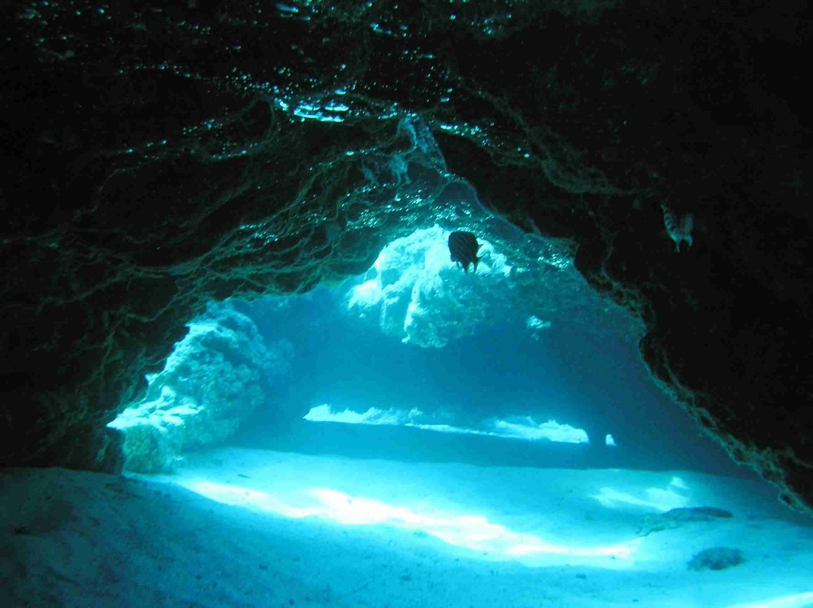
  • One of the most interesting sites for new divers due to the caverns and caves.
  • This is the only place in Cyprus where you can dive into a cave and surface inside a mountain where you can see stalactites.
  • The marine life in the area is not particularly rich, but the experience of the cave is certainly worth it.

Larnaca

Zenobia Shipwreck Larnaka

Larnaca

Embark on an exciting scuba diving expedition in Larnaca, revealing its underwater treasures and unexplored dive spots, a haven for scuba diving enthusiasts seeking aquatic exploration.

Alexandria Shipwreck

Dive Spot:

Alexandria Shipwreck

Min. Qualification:

Advanced and Boat Diver

Site Type:

Wreck

Max Depth:

30m

Dive Type:

Recreational and Technical Diving

Visibility:

20m+

Access:

Boat Only

GPS:

Characteristics

  • One of the very few wooden shipwrecks!
  • Alexandria used to be a fishing boat and sat perfectly when sunk in 2006.
  • Alexandria is 30m long and 9m wide.
  • Beautiful marine life with a significant number of various kinds of schools of fish.
  • One of the nicest wreck dive sites in Cyprus!
  • Very small swim-through. It is convenient for technical diving due to its depth but for not advanced wreck diving.

HMS Cricketwreck

Dive Spot:

LEF1

Min. Qualification:

Advanced and Boat Diver

Site Type:

Wreck

Max Depth:

32m

Dive Type:

Recreational and Technical Diving

Visibility:

20m+

Access:

Boat Only

GPS:

Characteristics

  • The ship was used as target practice by the British military.
  • Eventually, the ship sunk in 1947 off the coast of Larnaca.
  • HMS cricket is 72m long and 11 m wide.
  • One can see groupers, lionfish, seabreams, sea slugs, moray eels, tube warms, starfish.
  • One of the nicest wreck dive sites in Cyprus.
  • The wreck is upside down.
  • There are some swim-through options for wreck diving.

LEF1

Dive Spot:

LEF1

Min. Qualification:

Open Water

Site Type:

Wreck & Reef

Max Depth:

13m

Dive Type:

Recreational Diving

Visibility:

Winter: 15 m and Summer from 15-25m

Access:

Boat Only

GPS:

Characteristics

  • Reef stretching parallel with the shore / Many species of Marine life that is exclusive on this reef!
  • Perfect for underwater photography and fish identification specialty courses.
  • The small wreck LEF1 decorates the reef and small groupers use it as shelter.

Elpida Shipwreck

Dive Spot:

Elpida Shipwreck

Min. Qualification:

Advanced and Boat Diver

Site Type:

Wreck Dive

Max Depth:

30m

Dive Type:

Recreational And Technical Diving

Visibility:

Winter: 15 m and Summer from 15-25m

Access:

Boat Only

GPS:

Characteristics

  • The wreck is a reasonable size for 2 dives in a day. Safe for penetration for certified wreck divers.
  • Excellent wreck dives for beginner AOW and for experienced divers.
  • Long Bottom time as it starts from 14m and max depth is 30m with good visibility.

Zenobia Shipwreck

Dive Spot:

Zenobia Shipwreck

Min. Qualification:

Advanced and Boat Diver

Site Type:

Wreck Dive

Max Depth:

42m

Dive Type:

Recreational And Technical Diving

Visibility:

25m

Access:

Boat Only

GPS:

Characteristics

  • One of the top 10 shipwrecks in the world!
  • Zenobia is 172m long and 28m wide
  • The richest marine life in Cyprus, with groupers, lionfish, seabreams, sea slugs, moray eels, tube warms, starfish, and turtles.
  • Can be one of the most pleasant but also most challenging dives due to the depth and occasional currents.
  • One of the best sites in the world for wreck and advanced wreck diving.
  • Suitable also for scooter diving.
  • Multiple dives are required to explore all the aspects and beauties of the wreck.
  • MS Zenobia sunk on its side.
  • If diving in Cyprus, this is the one place that is not to be missed.

Akamas

Fontana Amorosa Scuba Diving

Akamas

Immerse yourself in an exhilarating scuba diving adventure in Akamas, exploring its underwater wonders and uncharted dive sites, a true paradise for scuba enthusiasts seeking extraordinary aquatic experiences.

Aphrodite Island

Dive Spot:

Aphrodite Island

Min. Qualification:

Open water / boat diver

Site Type:

Rocky Bottom

Max Depth:

18m

Dive Type:

Recreational Diving

Visibility:

20m plus in good conditions

Access:

Shore / Boat Access

GPS:

Characteristics

  • Diverse marine life.
  • It is across the Aphrodite baths (hence the name).
  • Very relaxed, easy and safe dive.
  • Small swim through canyons.

Aphrodites Rock

Dive Spot:

Aphrodites Rock

Min. Qualification:

Open Water / Boat Diver

Site Type:

Sandy and Rocky Bottom

Max Depth:

12m

Dive Type:

Recreational Diving

Visibility:

20m plus in good conditions

Access:

Difficult shore access or easy boat access

GPS:

Characteristics

  • Excellent for beginners.
  • One of the characteristics is a huge rock that emerges from the bottom of the sea.
  • Crystal clear water with sandy and rocky bottom.
  • Variety of marine life.
  • Very pleasant and relaxing dive site.

Amphitheater Bay

Dive Spot:

Amphitheater Bay

Min. Qualification:

Open Water

Site Type:

Sandy and Rocky Bottom

Max Depth:

18m

Dive Type:

Recreational Diving

Visibility:

20m plus in good conditions

Access:

Shore Access or Boat

GPS:

Characteristics

  • Excellent for beginners.
  • The main characteristic is the location of the rocks, which form an underwater amphitheater.
  • Crystal clear water with sandy and rocky bottom.
  • Some marine life at the rocky spots.
  • Very pleasant and relaxing dive site.

Fontana Amorosa

Dive Spot:

Fontana Amorosa

Min. Qualification:

Open Water

Site Type:

Sandy and Rocky Bottom

Max Depth:

15m

Dive Type:

Recreational Diving

Visibility:

20m plus in good conditions

Access:

Shore Access or Boat

GPS:

Characteristics

  • Excellent for beginners.
  • Crystal clear water with sandy and rocky bottom.
  • Some marine life at the rocky spots.
  • Very pleasant and relaxing dive site.

Blue Lagoon

Dive Spot:

Blue Lagoon

Min. Qualification:

Open Water

Site Type:

Sandy Bottom

Max Depth:

10m

Dive Type:

Recreational Diving

Visibility:

20m plus in good conditions

Access:

Shore Access or Boat

GPS:

Characteristics

  • Excellent for beginners.
  • Crystal clear water with sandy bottom.
  • Not particularly rich marine life.
  • Very pleasant and relaxing dive site.

Photiades Wall

Dive Spot:

Photiades Wall

Min. Qualification:

Open Water

Site Type:

Rocky Bottom / Reef / Drop Off

Max Depth:

25m

Dive Type:

Recreational Diving

Visibility:

20m plus in good conditions

Access:

Shore Access

GPS:

Characteristics

  • It is characterised by the long wall drop off.
  • If you are lucky and you catch a current, you may experience a nice and safe drift dive along the wall.
  • Easy dive and great opportunity to explore the richness of the Cypriot marine life.
  • Very rich marine life, including shoals of amberjack, crayfish and colored wrasse, groupers, star fish, sting rays, moray eels, etc.

St. Georgios Reef

Dive Spot:

St. Georgios Reef

Min. Qualification:

Open Water and Boat Diver

Site Type:

Rocky Bottom

Max Depth:

10m

Dive Type:

Recreational Diving

Visibility:

30m plus in good conditions

Access:

Boat Access Only

GPS:

Characteristics

  • It is located opposite the St. Georgios island.
  • Very rich marine life, including shoals of amberjack, crayfish and coloured wrasse, groupers, star fish, sting rays, moray eels, etc.
  • Easy dive and great opportunity to explore the richness of the Cypriot marine life.

St. Georgios Island

Dive Spot:

St. Georgios Island

Min. Qualification:

Open Water and Boat Diver

Site Type:

Island Drop Off Cave

Max Depth:

55m

Dive Type:

Recreational And Technical

Visibility:

30m plus in good conditions

Access:

Boat Access Only

GPS:

Characteristics

  • Characterised by the mountain wall on one side.
  • Very rich marine life, including shoals of amberjack, crayfish and coloured wrasse, groupers, star fish, sting rays, moray eels, etc.
  • A small shallow cave.
  • Excellent for technical diving.
  • Many areas to discover and it is worth visiting more than once to explore the area.

Mazaki Island

Dive Spot:

Mazaki Island

Min. Qualification:

Experienced Open Water

Site Type:

Rocky Bottom

Max Depth:

22m

Dive Type:

Recreational Diving

Visibility:

20m plus in good conditions

Access:

Boat Access

GPS:

Characteristics

  • One of the best diving sites in terms of marine life.
  • Frequently very difficult weather conditions due to its location. Strong currents.
  • The island barely makes it to the surface and diving around it is very interesting it.

Limassol

Costandis Shipwreck Limassol

Limassol

Plunge into an exhilarating scuba diving adventure in Limassol, exploring its aquatic wonders and hidden dive sites, a paradise for scuba enthusiasts in pursuit of new underwater experiences.

Jubilee Shoals

Dive Spot:

The Structures

Min. Qualification:

Advanced

Site Type:

Rocky / Drop off mountain wall / cave

Max Depth:

65m

Dive Type:

Recreational and Technical

Visibility:

20m plus in good conditions

Access:

Boat Only

GPS:

Characteristics

  • Characterised by the mountain wall on one side.
  • Very rich marine life, including shoals of amberjack, crayfish and coloured wrasse.
  • Multiple caves at various depths.
  • Excellent for technical diving.
  • Many areas to discover and it is worth visiting more than once to explore the area.

The Structures

Dive Spot:

The Structures

Min. Qualification:

Open Water and Boat Diver

Site Type:

Artificial Reef

Max Depth:

22m

Dive Type:

Recreational Diving

Visibility:

15m plus in good conditions

Access:

Boat Only

GPS:

Characteristics

  • This is a very recent artificial reef that was created in 2016/2017.
  • Rich marine life, with groupers, lion fish, seabreams, sea slugs, moray eels, tube warms.
  • Usually there are currents, but it is still very safe.
  • Frequent turtle sighting.

Lady Thetis Shipwreck

Dive Spot:

Lady Thetis Shipwreck

Min. Qualification:

Open Water and Boat Diver

Site Type:

Wreck

Max Depth:

19m

Dive Type:

Recreational Diving

Visibility:

20m+

Access:

Boat Only

GPS:

Characteristics

  • Lady Thetis is one of the two ships sunk to promote diving in the area (along with Costandis).
  • The boat was a passenger vessel and was sunk in February 2014.
  • Rich diverse marine life, with groupers, lion fish, seabreams, sea slugs, moray eels, tube warms.
  • Usually there are currents, but it is still very safe.
  • It is located 200m from Costandis.
  • It is excellent for scooter diving

Costandis Shipwreck

Dive Spot:

Costandis Shipwreck

Min. Qualification:

Open Water and Boat Diver

Site Type:

Wreck

Max Depth:

24m

Dive Type:

Recreational Diving

Visibility:

20m+

Access:

Boat Only

GPS:

Characteristics

  • Costandis is one of the two ships sunk to promote diving in the area (along with Lady Thetis)!
  • The boat was a USSR Trawler built in 1989 and was sunk February 2014.
  • Rich marine life, with groupers, lion fish, seabreams, sea slugs, moray eels, tube warms.
  • Usually there are currents, but it is still very safe
  • It is located 200m from Lady Thetis.
  • It is excellent for scooter diving

Paphos

Vera K Shipwreck Paphos

Paphos

Dive into an exciting scuba diving exploration in Paphos, uncovering its underwater marvels and uncharted dive locations, a haven for scuba enthusiasts seeking aquatic adventures beneath the surface.

Roman Wall (Structures)

Dive Spot:

Roman Wall (Structures)

Min. Qualification:

Open Water and Boat Diver

Site Type:

Artificial Reef

Max Depth:

4m

Dive Type:

Recreational Diving

Visibility:

10m plus in good conditions

Access:

Easy Access From The Shore

GPS:

Characteristics

  • This is the newest artificial reef that was created in October 2019.
  • Suitable for beginners.
  • Very basic Cyprus marine life.

White Star Shipwreck

Dive Spot:

White Star Shipwreck

Min. Qualification:

Open Water and Boat Diver

Site Type:

Wreck

Max Depth:

18m

Dive Type:

Recreational Diving

Visibility:

20 m plus in good conditions

Access:

Boat Only

GPS:

Characteristics

  • The wreck lies on a sandy bottom.
  • It was a Russian fishing boat that sunk in 2007.
  • One will see mostly groupers and sea breams.
  • Occasional currents, but still safe to dive.

Pistol Cave

Dive Spot:

Pistol Cave

Min. Qualification:

Open Water

Site Type:

Rocky and sandy bottom

Max Depth:

12m

Dive Type:

Recreational Diving

Visibility:

20m plus in good conditions

Access:

Easy access from the shore

GPS:

Characteristics

  • Small caverns and caves.
  • Suitable for beginners and more experienced divers.
  • Mostly flat sandy surface with rocky spots.
  • Regular Cyprus marine life.

Amphora Cave

Dive Spot:

Amphora Cave

Min. Qualification:

Open Water and Boat Diver

Site Type:

Rocky and sandy bottom

Max Depth:

12m

Dive Type:

Recreational Diving

Visibility:

20m plus in good conditions

Access:

Boat Only

GPS:

Characteristics

  • Most suitable for beginners.
  • Mostly flat sandy surface with rocky spots.
  • Regular Cyprus marine life.
  • It is characterised by the small cave where one can see a small amphora.

Vera K Shipwreck

Dive Spot:

Vera K Shipwreck

Min. Qualification:

Open Water and Boat Diver

Site Type:

Wreck

Max Depth:

11m

Dive Type:

Recreational Diving

Visibility:

20 m plus in good conditions

Access:

Boat Only

GPS:

Characteristics

  • The ship was a Lebanese freighter.
  • The ship ran aground in 1972 in shallow waters, and for safety purposes it was sunk in 1974.
  • The wreck is almost fully destroyed with the exception of some archways suitable for swim throughs.
  • There are occasionally strong currents, but it is still a very safe dive • Basic Cyprus marine life.

Achilleas Shipwreck

Dive Spot:

Achilleas Shipwreck

Min. Qualification:

Open Water and Boat Diver

Site Type:

Wreck

Max Depth:

11m

Dive Type:

Recreational Diving

Visibility:

20m+

Access:

Boat Only

GPS:

Characteristics

  • The wreck lies on a sandy bottom.
  • It was a Greek boat built in 1949 that exploded and sunk in 1975.
  • It is 53m long.
  • Very basic Cyprus marine life surrounds the wreck.

Amphitheater

Dive Spot:

Amphitheater

Min. Qualification:

Open Water and Boat Diver

Site Type:

Rocky and sandy bottom

Max Depth:

21m

Dive Type:

Recreational Diving

Visibility:

20m plus in good conditions

Access:

Boat Only

GPS:

Characteristics

  • The rocks take the shape of an amphitheater.
  • Most suitable for beginners.
  • Mostly flat sandy surface with rocky spots.
  • Regular Cyprus marine life.

Famagusta

Nemesis III Shipwreck Protaras

Famagusta

Dive into an exhilarating underwater journey in Famagusta, exploring its aquatic wonders and hidden dive sites. This area serves as an oasis for scuba diving enthusiasts in pursuit of new aquatic adventures.

Octopus

Dive Spot:

Octopus

Min. Qualification:

Open Water

Site Type:

Rocky

Max Depth:

15m

Dive Type:

Recreational Diving

Visibility:

20m plus in good conditions

Access:

Access from the shore (rocky entrance)

GPS:

Characteristics

  • One of the most beautiful dive sites in the area
  • Rich marine life including moray eels, sea urchins, lion fish, nudi branch, and grouper fish, but it is most famous for the numerous octopus
  • Excellent site for beginners and advanced divers
  • Very suitable dive site for skills, including mapping, night diving, navigation, and deep dives
  • Easy access to all type of cars

Green Bay

Dive Spot:

Green Bay

Min. Qualification:

Open Water

Site Type:

Shore dive

Max Depth:

11m

Dive Type:

Recreational Diving

Visibility:

20m plus in good conditions

Access:

Very easy access from the shore (walk in)

GPS:

Characteristics

  • A common practice is to feed the fish at less than 5m depth
  • Frequent turtle sighting
  • Hundreds of seabreams around the feeding area
  • Easy access to all types of cars
  • Easiest dive site in the area (walk-in entry)
  • Rarely there is a current or waves
  • Divers can see the numerous artificial statues at 10m depth
  • Most suitable for introductory dives and beginners

    Kyrenia Shipwreck

    Dive Spot:

    Kyrenia Shipwreck

    Min. Qualification:

    Advanced and Boat Diver

    Site Type:

    Wreck Dive

    Max Depth:

    23m

    Dive Type:

    Recreational Diving

    Visibility:

    20m plus in good conditions

    Access:

    Boat Only

    GPS:

    Characteristics

    • Sunk in March 2015 to promote diving in the area.
    • The Kyrenia wreck was a Greek navy boat originally called HS Knossos (renamed Kyrenia in 2000).
    • The marine life is not as rich as in the other wrecks.
    • Very nice and safe swim-throughs for basic wreck diving.
    • Usually, there are good conditions without any strong currents.

    Green Bay Cave

    Dive Spot:

    Green Bay Cave

    Min. Qualification:

    Open Water

    Site Type:

    Rocky bottom, small caverns (through and through)

    Max Depth:

    17m

    Dive Type:

    Recreational Diving

    Visibility:

    20m plus in good conditions

    Access:

    Very easy access from the shore (walk in)

    GPS:

    Characteristics

    • Approximately 10m of swimming/diving from the entry point
    • Beautiful through-and-through caverns with corals
    • Excellent spot for scooter diving (DPV)
    • Lionfish in the caverns
    • Other cave-specific marine life
    • Turtles and Moray Eels
    • Easy access to all type of cars

    Chappel (Agioi Anargyroi)

    Dive Spot:

    Chappel (Agioi Anargyroi)

    Min. Qualification:

    Open Water

    Site Type:

    Rocky, sandy, drop off (cliff)

    Max Depth:

    40m

    Dive Type:

    Recreational and Technical Diving

    Visibility:

    20m plus in good conditions

    Access:

    Easy access up to the entry point (steps from the Chapel), but difficult entry and exit point. Entry point 8m depth

    GPS:

    Characteristics

    • One of the most beautiful dive sites in the area with excellent visibility and changing scenery
    • Numerous marine life including moray eels, sea urchins, lionfish, nudibranchs, grouper fish, and seabreams.
    • Excellent site for both beginners to technical divers
    • Very suitable dive site for night diving, navigation, and deep dives
    • One of the most scenic places in the area, with a beautiful chapel and beautiful sunset view.
    • Easy access to all types of cars

    Cyclopes Caves

    Dive Spot:

    Cyclopes Caves

    Min. Qualification:

    Open Water

    Site Type:

    Rocky, sandy, drop off (cliff)

    Max Depth:

    45m

    Dive Type:

    Recreational and Technical Diving

    Visibility:

    20m plus in good conditions

    Access:

    Easy access from the entry point (entry depth 1m)

    GPS:

    Characteristics

    • One of the most beautiful dive sites in the area.
    • The cliff hosts numerous marine life including moray eels, sea urchins, starfish, lionfish, nudibranchs, grouper fish, and seabreams.
    • Excellent site for both beginners to technical divers.
    • Very suitable dive site for skills, including mapping, night diving, navigation, and deep dives.
    • Beautiful view outside the dive site from the so-called Cyclopes caves (a cave above the dive site).
    • Easy access to all types of cars.

    Da Costa

    Dive Spot:

    Da Costa

    Min. Qualification:

    Open Water

    Site Type:

    Shore dive

    Max Depth:

    11m

    Dive Type:

    Recreational Diving

    Visibility:

    15m plus in good conditions

    Access:

    Very easy access from the shore (walk in)

    GPS:

    Characteristics

    • One of the most beautiful dive sites in the area.
    • One of the easiest dive sites in the area (walk-in entry)
    • Most suitable for introductory dives and beginners
    • Rarely there are waves
    • Mostly flat sandy surface with rocky spots hosting small marine life
    • Easy access to all types of cars
    • Frequent turtle sighting

    Sea Caves

    Dive Spot:

    Sea Caves

    Min. Qualification:

    Open Water

    Site Type:

    Flat sandy and small through and through caverns

    Max Depth:

    12m

    Dive Type:

    Recreational Diving

    Visibility:

    20m plus in good conditions

    Access:

    Two entry points: 1 with 1.5m drop off and one with 3m drop off

    GPS:

    Characteristics

    • One of the easiest dive sites in the area.
    • One of the most interesting sites for new divers due to the caverns.
    • Multiple swim-throughs and through and through caverns.
    • Cavern-specific marine life.
    • Not particularly easy access for saloon cars.

    The Canyon

    Dive Spot:

    Sea Caves

    Min. Qualification:

    Open Water (and Boat Diver if access by boat)

    Site Type:

    Sandy bottom & drop off (cliff)

    Max Depth:

    20m

    Dive Type:

    Recreational Diving

    Visibility:

    20m plus in good conditions

    Access:

    Not easy access from the shore, rocky entrance, (not suitable for beginners), boat diving suggested

    GPS:

    Characteristics

    • Very beautiful and distinct due to the canyon entry with cliffs left and right
    • Rocky drops off up to 18m and then a sandy surface
    • Entry and exit points can be challenging especially if there are waves and currents
    • One of the nicest dive sites for more experienced divers
    • Not suitable for non 4x4 cars
    • Frequent sting ray sightings

    Cape Greco (Antennas)

    Dive Spot:

    Cape Greco Antennas

    Min. Qualification:

    Open Water

    Site Type:

    Rocky bottom with small caverns

    Max Depth:

    16m

    Dive Type:

    Recreational Diving

    Visibility:

    20m plus in good conditions

    Access:

    Rocky entrance (2-3 meters drop off)

    GPS:

    Characteristics

    • Easy and interesting dive site.
    • Very rich in small marine life due to the rocky bottom.
    • Very good for night diving.
    • Excellent site for navigation and other skills.
    • Easy access for all cars.

    Nemesis III Shipwreck

    Dive Spot:

    Cape Greco Antennas

    Min. Qualification:

    Advanced and Boat Diver

    Site Type:

    Wreck Dive

    Max Depth:

    26m

    Dive Type:

    Recreational Diving

    Visibility:

    20m plus in good conditions

    Access:

    Boat Only

    GPS:

    Characteristics

    • Easy and interesting dive site.
    • Sunk in December 2013 to promote diving in the area.
    • Nemesis III is a 25m long and 6m wide fishing vessel.
    • Very rich marine life, with groupers, lionfish, seabreams, sea slugs, moray eels, and tube warms.
    • Very nice and safe swim-throughs for basic wreck diving.
    • Usually, there are good conditions without any strong currents.
    • It is only 90 meters from the Liberty wreck.
    • Excellent for scooter diving to visit both the Nemesis and Liberty wrecks.

    Liberty Shipwreck

    Dive Spot:

    Liberty Shipwreck

    Min. Qualification:

    Advanced and Boat Diver

    Site Type:

    Wreck Dive

    Max Depth:

    27m

    Dive Type:

    Recreational Diving

    Visibility:

    20m plus in good conditions

    Access:

    Boat Only

    GPS:

    Characteristics

    • Sunk in May 2009 to promote diving in the area.
    • Liberty was a Russian cargo ship (37m long and 10m wide).
    • It is only 90 meters from the Nemesis wreck.
    • Very rich marine life, with groupers, lionfish, seabreams, sea slugs, moray eels, and tube warms.
    • Very nice and safe swim-throughs for basic wreck diving.
    • Usually, there are good conditions without any strong currents.
    • Excellent for scooter diving to visit both the Nemesis and Liberty wrecks.

    Troodos

    Troodos RAF winter

    Troodos

    Discover the Majestic Trails of Troodos.

    Mnimata Ton Piskopon

    Area:

    Troodos

    Length:

    8km

    Duration:

    3hours

    Difficulty:

    Type:

    Out & Back

    GPS:

    Description

    The starting point is located approximately 300m up on the narrow paved road. After a 1km journey on a widened path for easy wheelchair access, the hiker reaches a crossroad with a wooden sign indicating "Mnimata Piskopon" (northwest), while the first kilometer is part of the "Kampos tou Livadiou" trail. It ends at the dirt road that connects Platanias with the church of Agios Nikolaos Stegis (12th century), which features exceptional frescoes and is included in the UNESCO World Heritage List https://whc.unesco.org/

    The trail passes through clusters of black pine and follows a route near the cliffs, offering views of the Chromio River, the Solea Valley, and Morphou Bay. The trail ends at the dirt road connecting Platanias, Apotheeri, and Agios Nikolaos with three different routes leading to Agios Nikolaos  Stegis in the village of Kakopetria, Platanias, and vice versa. It connects with the Kampos tou Livadiou Path and the Livadi Path.

    Livadi (Wheelchair Suitable)

    Area:

    Troodos

    Length:

    1.5 km

    Duration:

    0.5hours

    Type:

    Circular

    GPS:

    Description

    A route through a natural forest of black pine with a view towards the Solea Valley.

    This trail winds through a lush forest of black pine and foetid juniper, home to ancient trees. A viewpoint offers vistas of Chromium River and Solea Valley. For the complete route, return from the viewpoint for about 100 meters, then follow the right path as indicated. Tree logging ceased in 1972, prioritizing biodiversity, water resources, and landscape preservation. Enjoy the picnic site with drinking water and visit the Troodos Visitor Centre for insights into the local environment.

    Kaledonia Waterfall

    Area:

    Troodos

    Length:

    4km

    Duration:

    1.5hours

    Type:

    Linear

    GPS:

    Description

    Starting from the side of Troodos Square, the trail passes through dense forests and follows along the course of Kryos Potamos, which has a permanent flow of water. It passes by the Kaledonia waterfalls and ends at Psilo Dentro in Upper Platres. From starting point (a) to the Kalidonia waterfalls, it is part of the European Path E4.

    Persephone

    Area:

    Troodos

    Length:

    4km

    Duration:

    1hour

    Type:

    Linear

    GPS:

    Description

    Rich vegetation, where the hiker passes through a dense forest of black pine for the first 2km, and excellent views from the endpoint at the location Makria Kontarka. The trail can be combined with the Pouziaris and Kaledonia trails. Approximately 500 meters before the endpoint, the trail intersects with the forest road that leads from Troodos Square to Kryo Potami. It is part of the European Path E4.

    Atalante

    Area:

    Troodos

    Length:

    14km

    Duration:

    4hours

    Difficulty:

    Type:

    Circular

    GPS:

    Description

    The trail follows a path around Chionistra at an altitude of 1700-1750m, passing through dense clusters of black pine and Troodos juniper. There is one of the largest juniper trees, approximately 800 years old. It offers excellent views in general of the island's regions. Of particular interest is the entrance to a gallery for chromium mining that has been out of operation since 1982.

    The trail ends on the Troodos - Prodromos road after 9km. To continue, one must cross the main road and walk approximately 200m on the Chromio Houses forest road towards Agios Nikolaos Stegis. There is a wooden signpost indicating the direction of the trail. From there, the trail continues with a route roughly parallel to the main road and ends at Troodos Square. There is a drinking water fountain 3km from the starting point. Its course is parallel to the Artemis Trail, and at points where the routes approach each other, they can be combined with hiking on the Artemis Trail.

    Famagusta

    Agioi Anargyroi to Sea Caves Trail Famagusta

    Famagusta

    Embark on an exciting hiking exploration in Famagusta, revealing its natural marvels and lesser-explored trails, a haven for outdoor adventurers seeking novel experiences.

    Panagia – Agioi Saranta

    Area:

    Protaras

    Length:

    2.5km

    Duration:

    45mins

    Type:

    Linear

    GPS:

    Description

    The picturesque chapel of Agioi Saranta. Part of the path has a parallel route and can be combined with the European Path E4. The most peculiar and eccentric church in Cyprus is undoubtedly Ayioi Saranta cave church. Situated in an unexpectedly unpredictable location, it remains concealed within a cave in the Famagusta / Protaras area.

    More precisely, it's skillfully hidden in a rugged area near Profitis Elias Church. While countless locals and tourists visit the prominent Profiti Elias Church, just a short distance away, Agioi Saranta Church remains tucked away in the serene wilderness of nature.

    Panagia – Agios Ioannis

    Area:

    Protaras

    Length:

    2.8km

    Duration:

    45mins

    Type:

    Linear

    GPS:

    Description

    Connected to the paths Prophet Elias - Konnos and Panagia - Agioi Saranta. The picturesque churches of Agios Ioannis and Agioi Saranta. Part of the path has a parallel route and can be combined with the European Path E4.

    This trail is known for its serene ambiance, with churches and the sea dominating the landscape. It provides an outstanding vantage point overlooking Mesaoria, and for a moment of relaxation, you can take a seat on the benches and quench your thirst with water from the nearby fountain.

    Prophet Elias – Konnos

    Area:

    Protaras

    Length:

    8.5km

    Duration:

    3hours

    Difficulty:

    Type:

    Linear

    GPS:

    Description

    You can Enjoy the panoramic view from Prophet Elias Church. Passes by the churches of Agioi Saranta and Agios Ioannis. The route ends at Konnos Beach. It is connected to the paths Panagia - Agioi Saranta, Panagia - Agios Ioannis, Konnos - Agioi Anargyroi, and Konnos - Cyclops Cave. The path has a parallel route and can be combined with the European Path E4.

    Sea Caves

    Area:

    Protaras

    Length:

    4km

    Duration:

    1.5hours

    Difficulty:

    Type:

    Circular

    GPS:

    Description

    The trail follows the coastline for a significant portion, offering excellent views. The caves contain fossil remains of marine organisms. The trail can also lead to Cape Greco and Agioi Anargyroi. It connects with the Cape Greco circular trail. Part of the trail runs parallel to and can be combined with the European Path E4.

    Konnos – Cape Greco

    Area:

    Protaras

    Length:

    6.3km

    Duration:

    2hours

    Difficulty:

    Type:

    Out & Back

    GPS:

    Description

    Discover this captivating 6.3km out-and-back trail near Ayia Napa, Αμμόχωστος, a region that offers a taste of moderate challenge and takes an average of 2 hours to traverse. Given its allure, this area is quite popular among hikers, ensuring you'll encounter fellow explorers during your journey. The trail is accessible year-round, revealing its beauty at any time.

    Your adventure unfolds with a lengthy walk along the scenic eastern coast of Cape Greco National Park, commencing from the northern point at Konnos Beach and unfurling toward the south. The trail closely follows the path of the E4 European Trail section within the park.

    This coastal trail is graced with luxuriant vegetation and presents excellent coastal views. It culminates at the Agioi Anargyroi Church, which is perched above a sea cave where hermits might have sought solitude in the past. This trail seamlessly connects with others, such as Konnos - Cyclops Cave, Agioi Anargyroi - Sea Caves, and Prophet Elias - Konnos. Furthermore, it harmonizes with the European Path E4, allowing for an extended adventure of exploration and wonder.

    Agioi Anargyroi – Sea Caves

    Area:

    Protaras

    Length:

    4km

    Duration:

    1.5hours

    Type:

    Linear

    GPS:

    Description

    This Path follows the coast and ends at Thalassines Spilies (Sea Caves). The area is suitable for diving. The trail passes through the natural bridge "Kamara tou Koraka" and beneath Cape Greco, offering excellent views and rich vegetation, as well as marine fossil remains. It connects with the Konnos - Agioi Anargyroi and Cape Greco trails. Part of the trail runs parallel to and can be combined with the European Path E4.

    Agioi Anargyroi

    Area:

    Protaras

    Length:

    2.3km

    Duration:

    45mins

    Type:

    Circular

    GPS:

    Description

    Flora consists of juniper (Juniperus phoenicea) and a picnic area. It connects with the Konnos - Agioi Anargyroi and Agioi Anargyroi - Thalassines Spilies trails. Part of the trail runs parallel to and can be combined with the European Path E4.

    Cape Greco

    Area:

    Protaras

    Length:

    2.5km

    Duration:

    45mins

    Type:

    Circular

    GPS:

    Description

    You can enjoy beautiful views, especially from the top of Cape Greco. The trail starts from an old quarry, features abundant vegetation, and includes the peak of Cape Greco, and impressive cliffs suitable for climbing. Fossil remains may be encountered. It connects with the Agioi Anargyroi and the Sea Caves trails. Part of the trail runs parallel to and can be combined with the European Path E4.


    Konnos – Cyclops Cave

    Area:

    Protaras

    Length:

    2.5km

    Duration:

    1hour

    Type:

    Circular

    GPS:

    Description

    This is a path along the coast with rich flora, leading to the picturesque Cyclops Cave and returning to Konnos Beach via another parallel route. It connects with the Konnos - Agioi Anargyroi and Prophet Elias - Konnos trails. Part of the trail runs parallel to and can be combined with the European Path E4.